Mississippi Gulf Fishing Banks, Inc.
Activity Report for the Period
August 14 - September 11, 2014
Summary
During this period there were two reef monitoring trips. On August 31, 2014, a trip was made to FH-2 and monitoring was performed on the St. Elmo, the Marguerite Culverts, and the Captain Kevin. On September 6, a visit was made to the Capt Le, a 74' Steel Hull Shrimp Boat that was rammed by the 130' supply boat Gloria May and sunk within the boundaries of FH-13. After that venture, an update check was made on FAD1 and then an effort was made to locate the NASA BRT which appears to be heavily damaged. Finally a monitoring dive was made on the Mike Jenner Reef.
Click Here for the PDF Version of this Report.
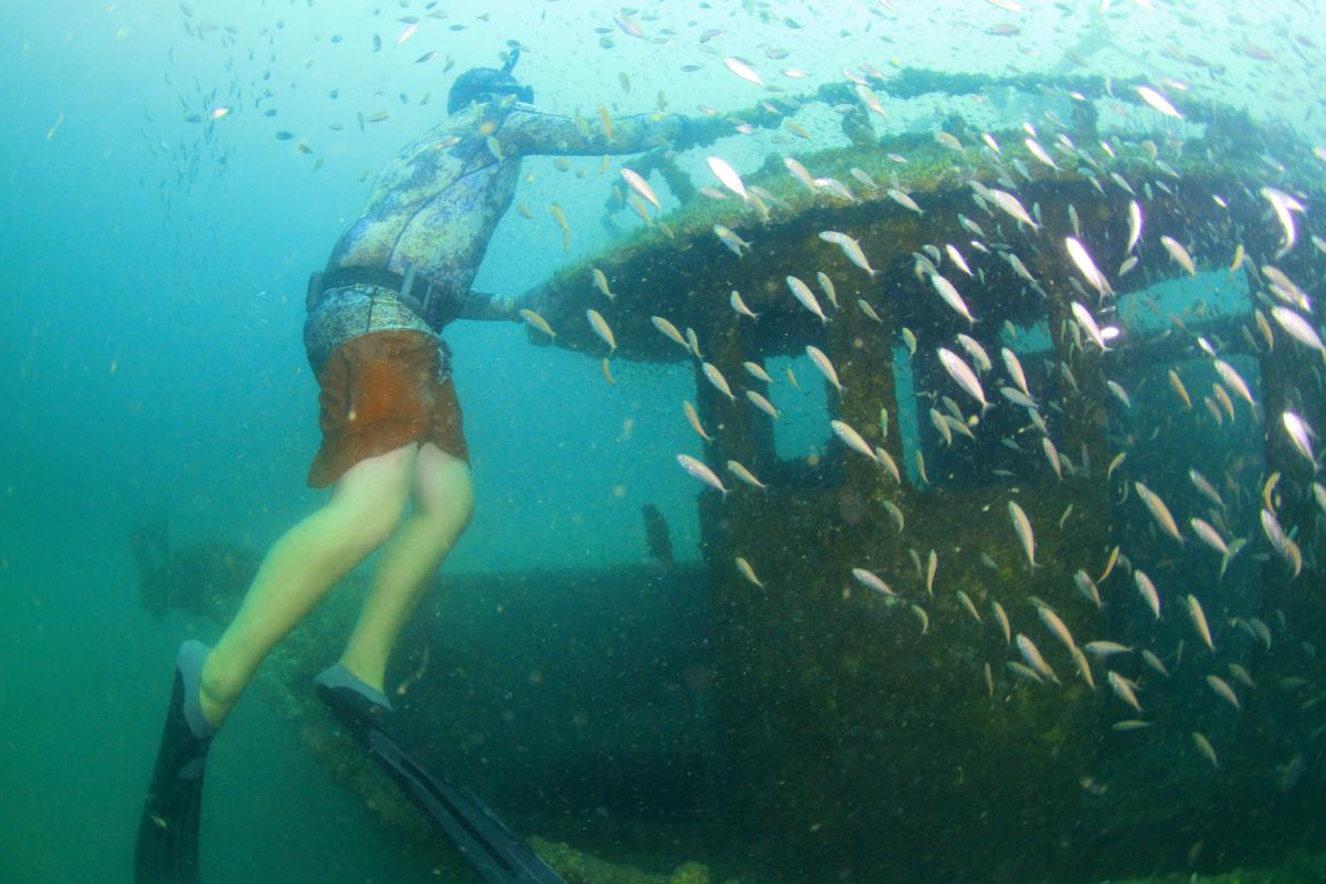
081011b St. Elmo Shrimp Boat 491F2
Position: 30°04.820'N / 88°33.278'W
Video: http://youtu.be/gJZTLCO2vqE
St. Elmo Web Gallery
This 70' Steel Hull Shrimp Boat washed ashore in Pass Christian Harbor during Hurricane Gustav in 2008. The Harbor had a lien on the Vessel and somehow obtained ownership and donated it to the DMR. The DMR Derelict Vessel Program paid 100% to recover the Vessel, environmentally clean it, and deploy it in FH-2. Previous visits were conducted on May 2, 2009, September 20, 2009, May 22, 2010, July 14, 2012, September 12, 2012, and September 29, 2013. Noted was an increase in the Triggerfish population, a few juvenile Amberjack showing up, healthy baitfish schools, a pair of spotfin butterflies, and cocoa damsels. Water clearance was measured at 50 feet, the bow pulpit at 58 feet, top of wheel house stern port at 55 feet, stern starboard corner top at 58 feet, stern starboard bottom hole at 65 feet.
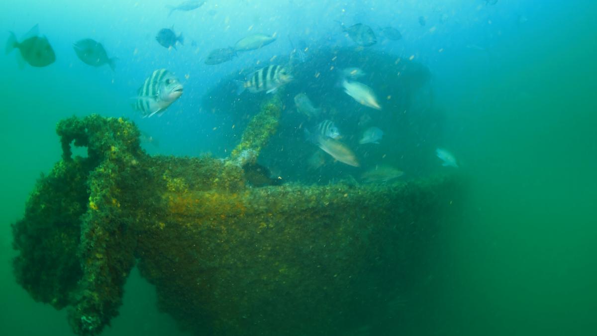
090930 Marguerite Culverts 508F2
Position: 30°05.041'N 88°33.432'W
Video: http://youtu.be/nBxZe_1xnAI
Gallery: http://www.primofish.com/reports/12Sept13/
These Culverts were deployed just Northeast of the old Marguerite Barge in FH-2 on September 30, 2009. A previous visit was made on August 25, 2013. Noted was a healthy population of red snapper, triggerfish, mangrove snapper, scamp grouper, and several juvenile amberjack. On both visits there was a school of tiny baitfish within the circumference of a vertically sitting culvert. Sea urchins were sighted denoting better water quality. Butterflies, cocoa damsels, and soft corals were also common throughout the reef and a medium sized horse conch was seen transiting a piece of rubble.
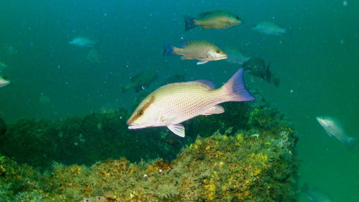
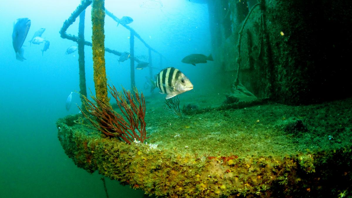
060424 Capt Kevin, 433F2
Position: 30°05.099'N / 88°33.490'W
Video: http://youtu.be/fAGeGpwGkiQ
Gallery: Capt Kevin Web Gallery
This Shrimp Boat was deployed near the center of FH13 at the above coordinates on September 9, 2006. Measurements were taken as follows, Bow 74', Port Gunwhale 71', Stern Port Bottom 80', Stern Port Corner 75', Top of Cage on Stern 69', and a minimum depth of 54' compared to a previous reading of 44 feet on April 20, 2008. Fish observations included Red Snapper (75-100/1-3 lbs.), Triggerfish (1), Scamp Grouper (2), Mangrove Snapper (8-10), Tomtates (20-25), Spadefish (125-150), and Sheepshead (6-8/2-6 lbs.), as well as a few Soapfish, Cocoa Damsels, and Sand Bass. There was also a Sea Turtle encounter.
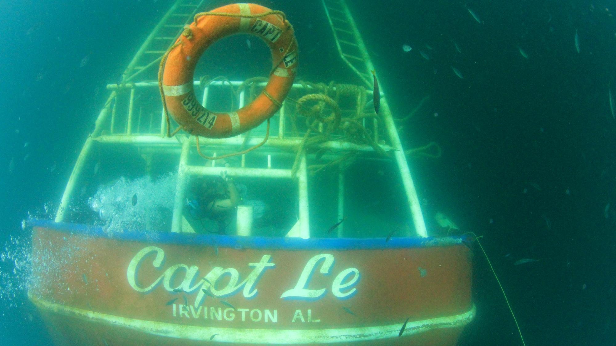
140825 Capt Le, 549F13 Depth 69'
Position: 30°02.914'N / 88°31.224'W
Video: http://youtu.be/eEeDuBgcchY
Capt Le Web Gallery
From news reports, it appears that the 130' Supply Boat “Gloria May” collided with the 74' Shrimp Boat “Capt Le” on Sunday, August 24, at around 10:40 pm about 18 miles south of Pascagoula. The Gloria May was not damaged badly and returned to port. The Capt Le sank within MGFB’s FH-13 site at the above coordinates. After finding out about the incident on September 6, a trip was made to assess the situation. The vessel landed bow down into the mud with only about 12 feet of water clearance. There was a strong smell of diesel but no visible signs of oil or fuel leakage. A large rope was drifting along the surface and there was a ball buoy marking the site. Nets, ropes, and loose items were also seen littering the wreck. The current indication is that the owner did not have insurance and that the Coast Guard was taking over recovery using federal pollution funds. A contractor was selected and subcontracted the work to Bosarge Diving to recover fuel and oil and to get the vessel in compliance with the permitted reef height of 50 feet. MGFB has contacted the Corps of Engineers about the possibility of raising the height requirement to a level that coincides with the nearby Pascagoula Ship Channel clearance of 42 feet.
140810 FAD1 Visit
Video: http://youtu.be/oVfFvYZ-L7E
FAD1 Update Web Gallery
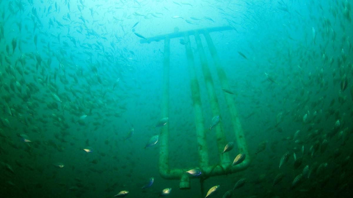
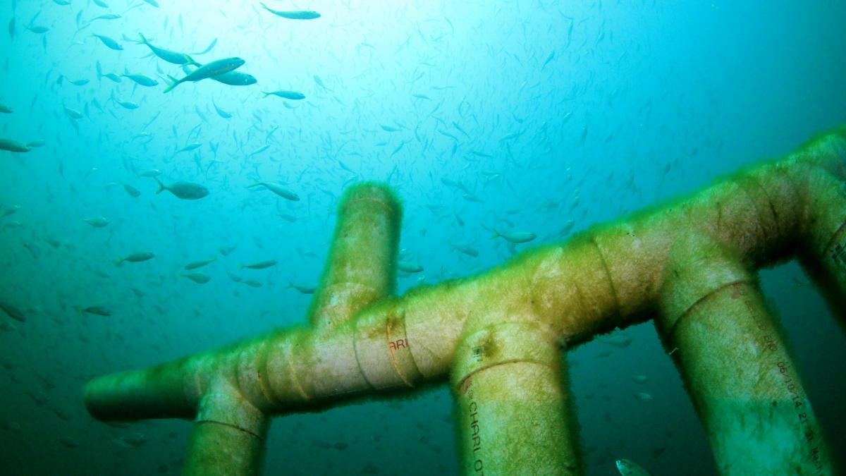
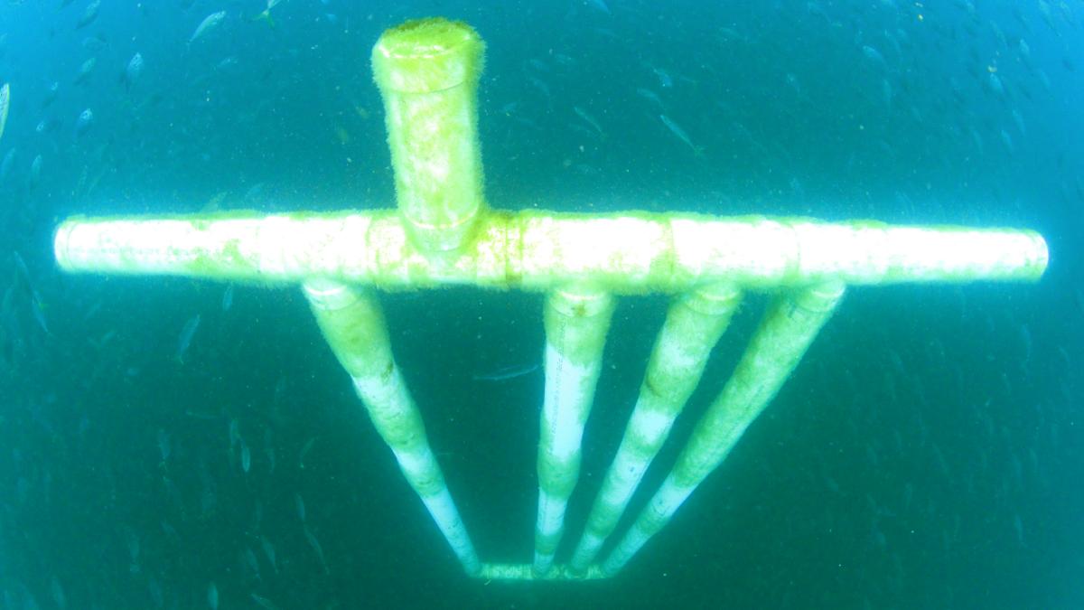
Deployed on August 10, this new test FAD (Fish Attraction Device) was created using 10 foot sticks of sewer pipe. It was also previously visited on August 23. It is proving to doing very well at attracting baitfish and algae growth and a few small barnacles are starting to form on the surface. Most of the snapper and gamefish are staying near the bottom at the pyramids, but the other pyramids in the area do not have the quantity of baitfish seen here. Also worth noting, there was a single arrow crab sightd on the August 23 visit that managed to climb up the rope to the FAD. On this visit there were no arrow crabs on the FAD itself, but down on the rope at the top of the pyramid were several arrow crabs (5-7) that setup residency.
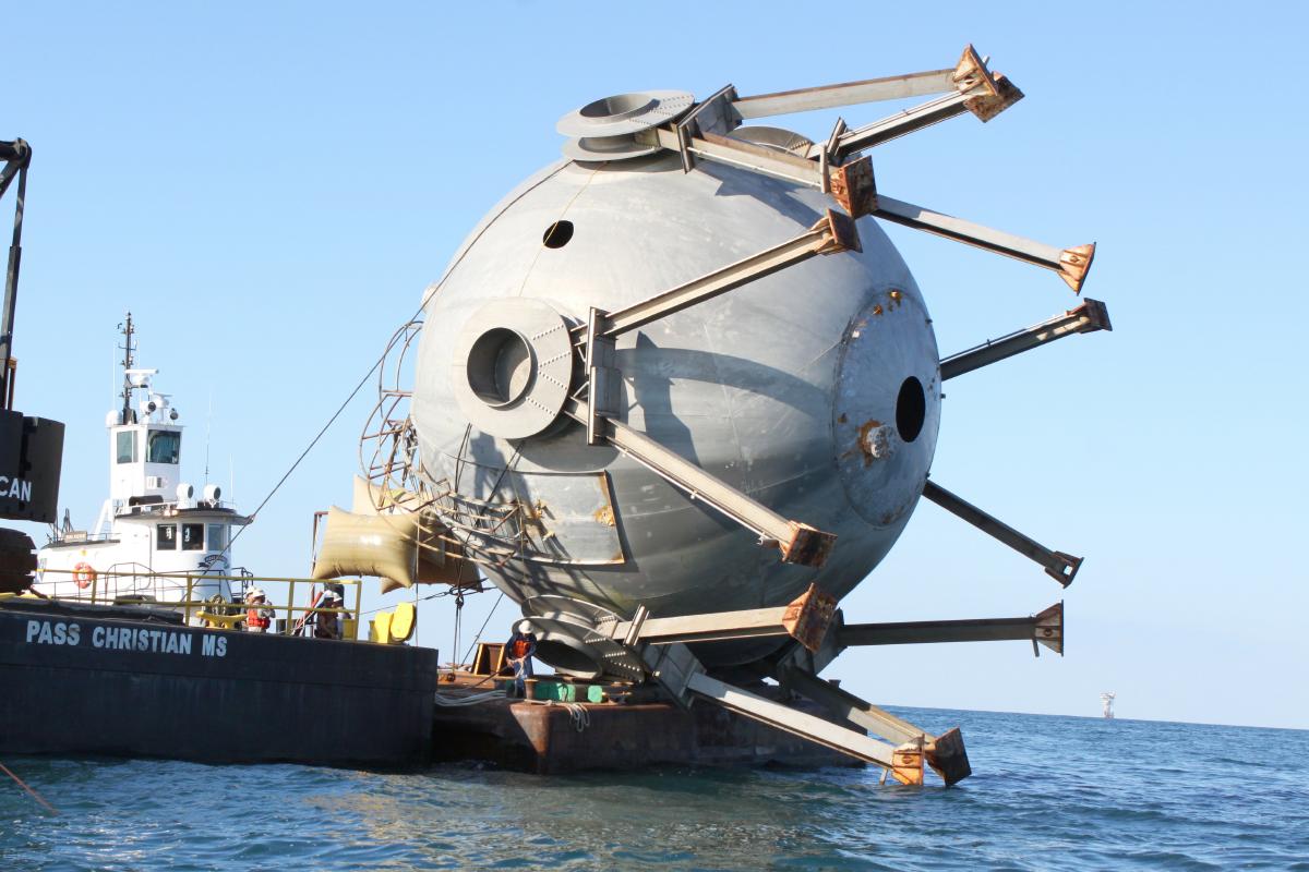
111026 NASA BRT 545F13
Position: 30°00.442'N / 88°31.424'W 85' Depth
NASA Employee Bryon Maynard and his crew of 5 orchestrated the deployment of the BRT (Big Round Thing) in FH-13. The BRT was a Hydrogen Accumulator Tank (HAT) that was used in the testing of the Saturn V Engines at NASA’s Stennis Space Center. It was deployed in the Southwest End of FH-13 in 85 feet of water on October 26, 2011. Previous visits were made on February 4, 2012 and July 16, 2012. Unfortunately on this trip it appears that the structure has been severely damaged, possibly struck by a large vessel. The initial dive was to tie a marker on it and to take followup video but the visibility was very poor within the last 10 feet of the water column and it appears there is only some fragments left with some splits observed in the shell. The marker was tied although poorly since an adequate tie point was not found. The last visit recorded a water clearance of 52 feet and it is now closer to 83 feet. A future visit with better visibility on the bottom is needed to attempt a better assessment of what has happened to this reef.
060624 Mike Jenner Reef 435F13
Position: 29°59.527'N / 88°29.610'W 87'
Video: http://youtu.be/pGEP9lQTGhs
Mike Jenner Web Gallery
This 145' River Tug Boat is sitting upright in about 86' of water within FH-13. Deployed post Hurricane Katrina, this vessel offers the highest relief in FH-13 at about 52 feet of water clearance. Noted was a Spanish Hogfish, typically a deepwater tropical fish, is the first one observed on MGFB reefs. A couple Blue Angels were sighted as well as juvenile amberjack and healthy schools of small mangove snapper. Red Snapper populations were weak which may indicate some commercial pressure. Several triggerfish and game sized grouper were also observed, as were large schools of baitfish. The presence of sea urchins denote some better water quality. A “message-in-a-botle” was also found near the starboard bow and an unknown statue which later were determined to have been placed by Robert Homes of Long Beach, MS. The items were left for a future diver to find.
HOME = http://mgfb.org/
Mark Primo Miller
PO Box 1737
Gautier, MS 39553
Phone:512-677-4661 (512-MPRIMO1)
PRIMOFISH or
PRIMO Computer Engineering